
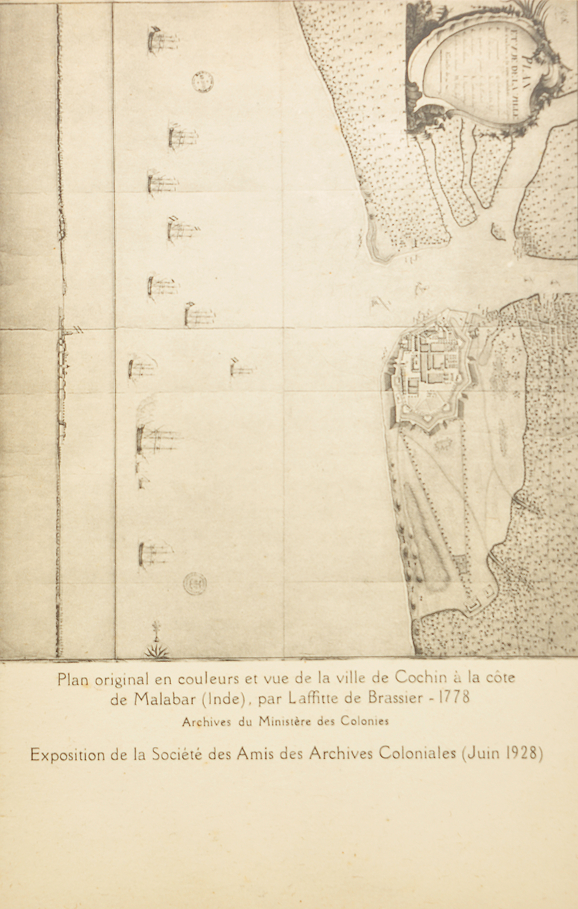
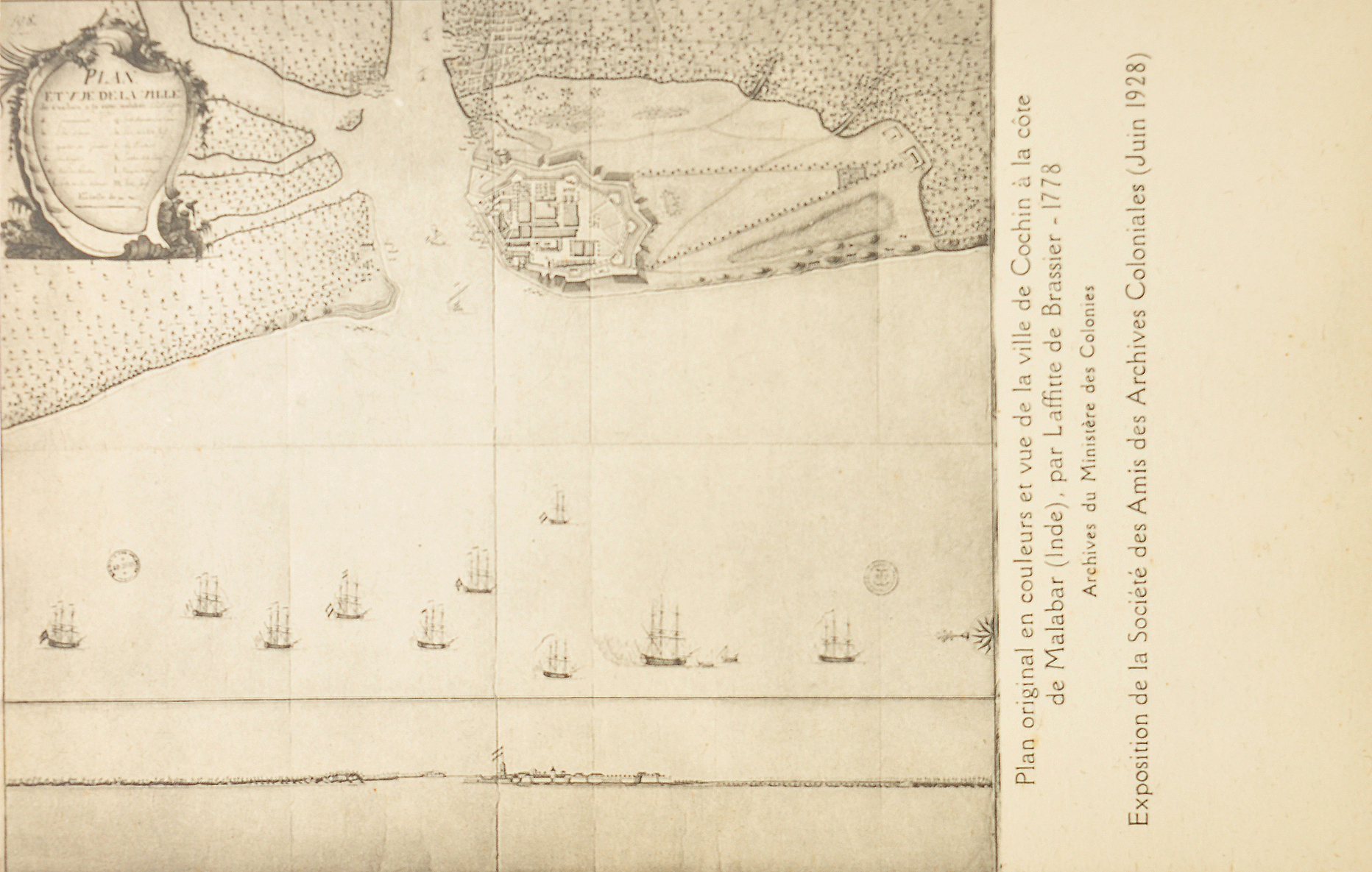
1778 Map of Fort Cochin on the Malabar Coast, 1928 Postcard

A 1928 postcard reproduces a rare 1778 map and panoramic view of Fort Cochin on India’s Malabar Coast. The French caption identifies it as a “Plan et vue de la ville de Cochin.” Prepared by Laffite de Brassier and later exhibited by the Société des Amis des Archives Coloniales in Paris in 1928. The map depicts the fortified settlement of Fort Cochin, its harbor, surrounding waterways, and several sailing vessels anchored offshore. Highlighting Cochin’s importance as one of the great maritime gateways of the Indian Ocean. Long before the rise of Bombay and Madras, Cochin was a thriving center of the spice trade. It attracted Arab, Chinese, Portuguese, Dutch, and British merchants to its shores.
Fort Cochin occupied a strategic position along the Kerala coast and became one of the earliest European colonial settlements in India. The Portuguese established a fort here in the early sixteenth century, transforming the town into a key trading post for pepper, cinnamon, and other valuable spices. The fort was named Fort Immanuel and was commonly known as Fort Cochin. Control later passed to the Dutch and eventually to the British, each leaving a distinct architectural and cultural imprint on the region. Click image to enlarge.
Did you know – the famous Chinese fishing nets seen in Kochi today are believed to reflect centuries-old trading links with China.