
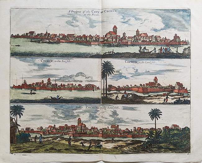
View Of Fort Cochin & Town, Antique Plan 1704

An antique 1704 hand-coloured and hand-made paper Plan of Fort Cochin and town. There are four views in this plan. The Portuguese built Fort does not exist now, it was steadily demolished first by the Dutch, then by the British colonists. The plan was drawn before the town and its structures were drastically modified by the Dutch. By the look of the plan, the Fort looked large. The beautiful buildings constructed by the Portuguese looked intact at the time.
The Dutch had taken control of Fort Cochin after driving out the Portuguese in 1663. They made drastic changes under their 110 years of rule, which included reducing the size of the fort. They demolished churches and beautiful buildings especially built by the Portuguese. So what is shown is the topography of the town before it was modified by other invading colonists.
See post- Fort Cochin – Antique Map Plan 1761.
Did you know- the original name of the fortification given by the Portuguese was Fort Emmanuel but as time passed the name changed to Fort Cochin that is stuck to this day. Read more about Fort Emmanuel.
From the collection- M F Hussain Painting – Air India Advertising Postcard 1960., Vintage Book 1912 – Kerala The Land Of Palms By I H Hacker., German Map Bombay With Waffen SS Stamp & Seal., British India Era Steam Locomotive – Old Photo 1935