
Click on the photo for better view
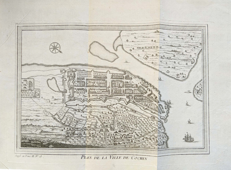
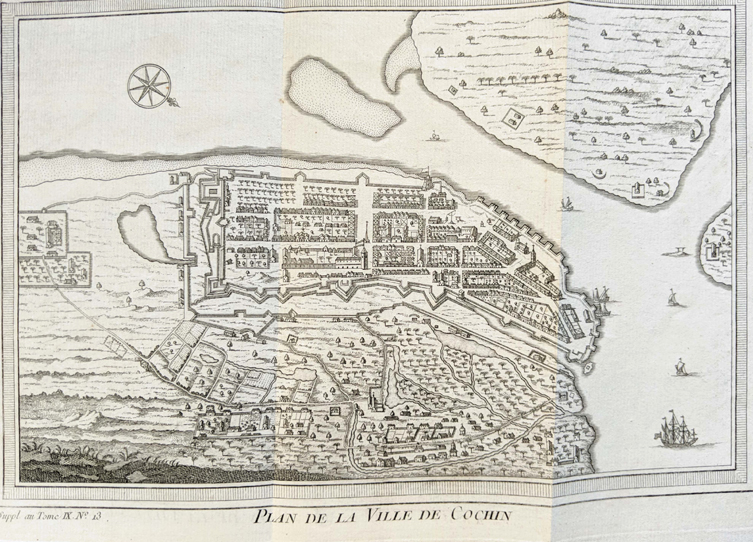
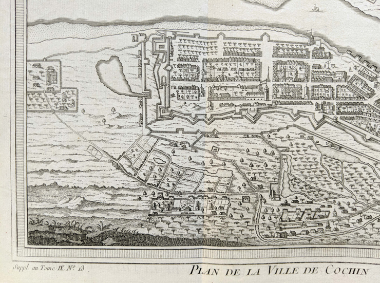
Fort Cochin – Antique Map Plan 1761
This is an antique map of Fort Cochin city dating to 1761. Originally drawn by French cartographer Jacques Nicolas Bellin. It measures- 35 x 24cm. The Portuguese were the first Europeans to arrive in India by the maritime route. Landing first at Calicut, now Kozhikode in 1498. For the sole purpose of procuring pepper that was indigenous only to the Malabar region.
Now considered a common household spice and not given a second glance. But from ancient times pepper was traded as a rare commodity in Europe, Egypt, Phoenicia, Babylonia, and so on. So prized that it was worth its weight in gold where only the wealthy could afford it. So much so that it aroused a great thirst amongst nations to find its source. The Portuguese were the foremost than the others in this race.
They forcefully extracted the secret from the Arab spice traders. Who visited the European shores regularly each year trading spice. Consequently, the King chose Vasco Da Gama to head an expedition. Da Gama bunched together with a few adventurers and thugs as protection for the journey. After the King’s financial support and blessings, the expedition set sail for Calicut the secret source of pepper.
A region they never heard about ever before. Landing at Calicut in 1498 that was north of the Malabar coast. Although the Zamorin or the local ruler extended a hearty welcome. But after a while, things did not go down well between them for some reason. There were distrust and skirmishes, and since good trade relations could not be maintained with the Zamorin.
The Europeans shifted their interest to Cochin many miles down south of the Malabar coast. After the Portuguese took control, Kochi grew from a small fishing village into a city of grand world standards. Which included the first European fort in India called Immanuel also called Fort Cochin. Which is shown in this plan. The Portuguese increasingly explored and expanded, setting up trading settlements along the Malabar coast. From Cannanore in the north to Quilon in the south.
See my post- Fort At Coylan – Antique Hand Colored Map / Plan 1668
Later discovering other regions like Madras, Mangalore, Goa, Diu, Surat, Bombay, Tuticorin, Nagapattinam, and so on. After a rule of 160 years, the Dutch took control of Kochi by ousting them. The British in 1795 (after 132 years) captured the city from the Dutch. Under both the Durch and British rules, the size of fortification would be reduced in size and eventually disappear. Not a trace of the fortification can be seen today although the place is still called Fort Cochin.
Read more- Black pepper.
Did you know- it is a heritage zone today.
From the collection– Raja Ravi Varma’s “Birth of Shakuntala” Oleograph of c1894., Parsi Fire Temple Mumbai – Old Postcard 1905., Vintage Book – History of The Bombay Army 1938.
The images are of the actual items from my collection. And Not a photocopy, pirated, reproduced, or stock photos or taken from other sources.
