Nizam’s Hyderabad As The Proposed Third Dominion, 1947 Map
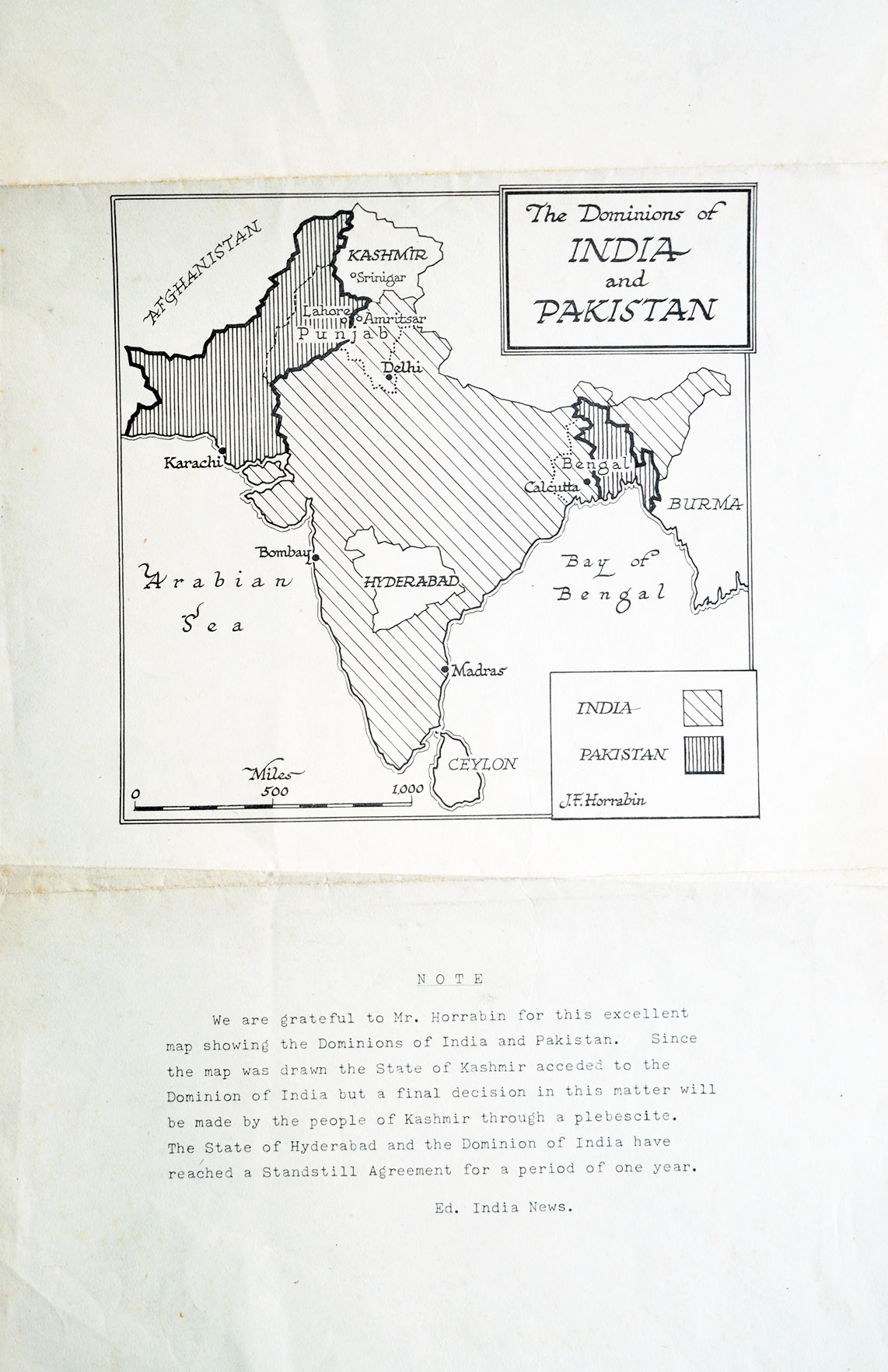
A rare 1947 map of the Dominions of India and Pakistan captures one of the most intriguing moments in the history of the Indian subcontinent. Besides the newly created Dominions of India and Pakistan, the map identifies the Princely State of Hyderabad as a proposed third dominion under the rule of the Nizam, Osman Ali Khan. One of the wealthiest princely states of its time, Hyderabad possessed remarkable autonomy, with its own army, railways, postal service, currency, passports, bank, and even an airline, making it unlike any other princely state during the final years of British rule.
Following India’s independence, the Nizam sought to keep Hyderabad independent rather than join either India or Pakistan. The Standstill Agreement signed with India in November 1947 temporarily preserved the status quo, while the map also reflects the uncertainty surrounding Kashmir shortly after Partition. The situation ultimately changed in September 1948 when Operation Polo led to Hyderabad’s integration into the Indian Union. As a historical document, this 1947 map offers a fascinating snapshot of a brief period when the political future of the Deccan, and also the Indian subcontinent, was still undecided.
Did you know – that Nizam’s Hyderabad state covered three linguistic areas: the modern-day regions of Telangana, Maharashtra, and Karnataka.