


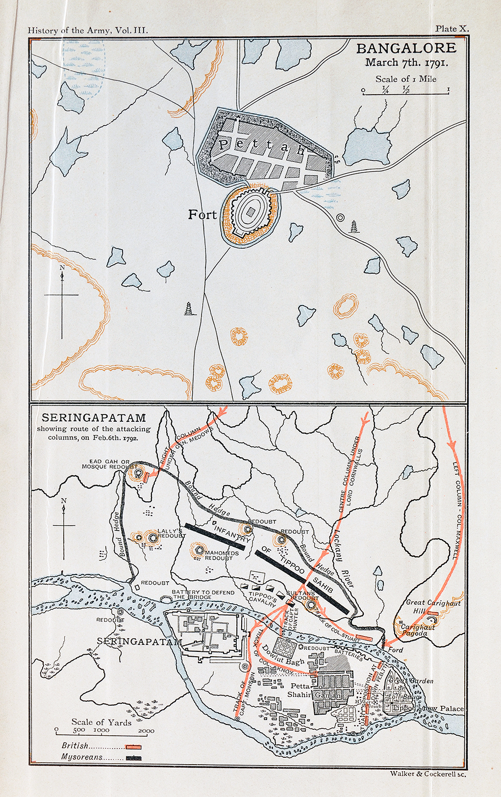
San Thome Fort Madras – Antique Map 1757
This is a rare antique 1757 map of the Portuguese and later Dutch Fort, located at present-day San Thome in Madras (now Chennai). Originally drawn by the Dutch Cartographer Francois Valentijn in 1674. Only a few may be aware that a Portuguese trading settlement with a fort existed in the Mylapore area of Chennai. Built in 1522, long before the British even arrived at Madras. The settlement was named San Thome.
Read more The Dutch Konnect.
The British, Dutch, and French would make their presence felt in the lucrative trade of calico cloth and spices. Leading to intense trade rivalries between the Europeans with bitter skirmishes. The fortress faced the batterings of the European countries at various times. Despite the Portuguese doing their best to reinforce manpower and weapons. Unfortunately, they were no match for the superior firepower of the enemies.
Ultimately the fortification came under the control first under the Dutch in the early 1600s, then the British in 1824. The locals would cart off the bricks and stones at various times. Thus leaving no trace of this great fortification today, except for the large outline of it shown on this map by the great cartographer Francois Valentijn. The smaller outline shows that of the Dutch Fort. Much before the British takeover the Dutch had captured San Thome and reduced the size of the original fortress. The outline of the moat is also visible. Click on the photo for better view.
Read more Lost Landmarks of Chennai. See post Fort St George In Madras – Antique Map / Plan 1782
Did you know- St Thomas Church in Chennai is possibly the only legacy of the Portuguese left today.
From the collection- Raja Ravi Varma’s Portrait Photo – Old Postcard 1904., Britishers On Elephant Back India – Old Photo 1890., Old Book – From Lisbon To Calicut 1956
