

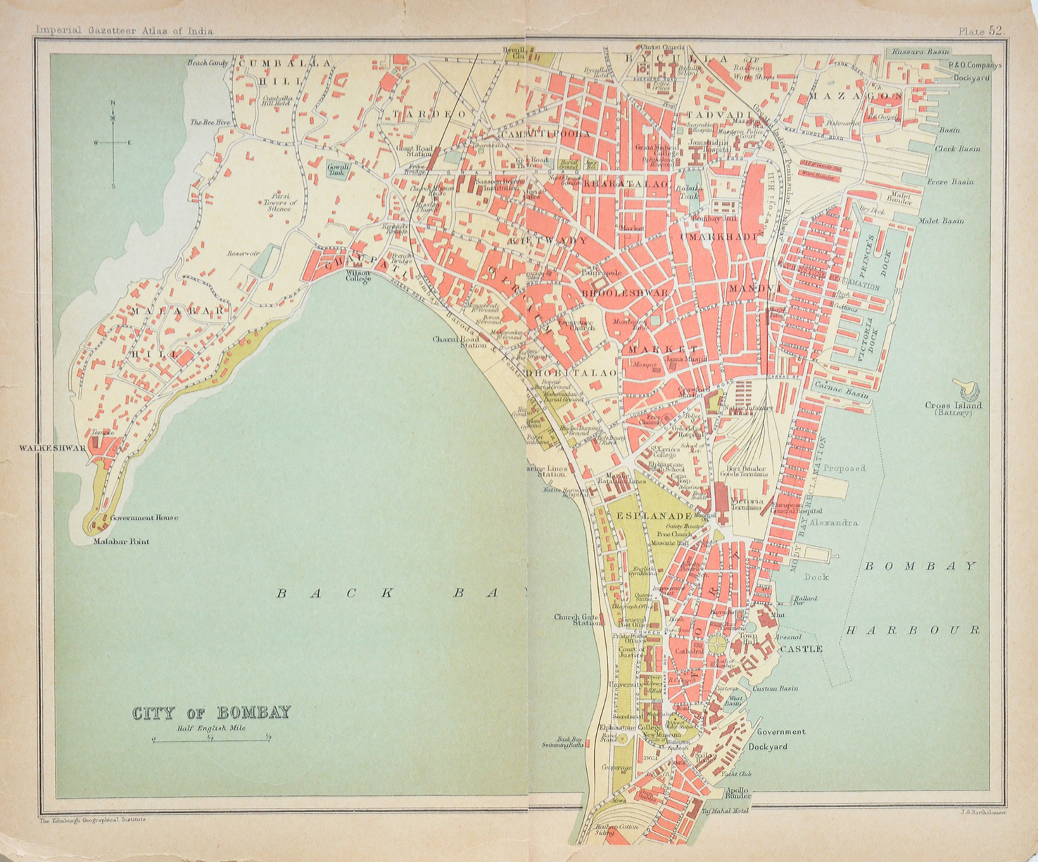
French Colonies In India, 1858 Map

This 1858 map shows the French colonies in India. The colonies include those that are underlined in red, on the west coast are Mahe and Calicut (now Kozhikode). On the eastern coast is Karikal, Pondicherry, Yanaon (Yanam), Balasore, Chandernagore (Chandannagar), Dacca (Dhaka).
This map seems to be an eye-opener regarding Calicut being a French protectorate. In 1774, the French flag was apparently hoisted on the Zamorin’s palace. A treaty was signed with the Zamorin where Calicut was placed under the protection of the French. In return, the Zamorin granted the French a complete monopoly over trade and the right to build forts wherever they pleased.
To read more on this go to A French Calicut?
The French arrived first at Surat in 1667 and established the first trading post in the subcontinent. Then on they rapidly established settlements: at Masulipatam (Machilipatnam) in 1669, and Chandernagore in 1773. They acquired Pondicherry from the Sultan of Bijapur in 1674. Mahe in around 1720. The inset images display – Lauriston, a map of Cochinchine (Vietnam), a caparisoned elephant, and Pondicherry harbour. Click on the image for better view.
Did you know – Jean Law De Lauriston was a military commander and Governor General of Pondicherry twice. Born in Paris in 1719, of Scottish origin
From the collection – Antique Painting of Madras Fort St George., Biplane Flying Boats In British India, 1930 Photo., Newly Completed Parliament House New Delhi, 1927., Bowring Institute Club In Bengaluru – Old Postcard 1907.