
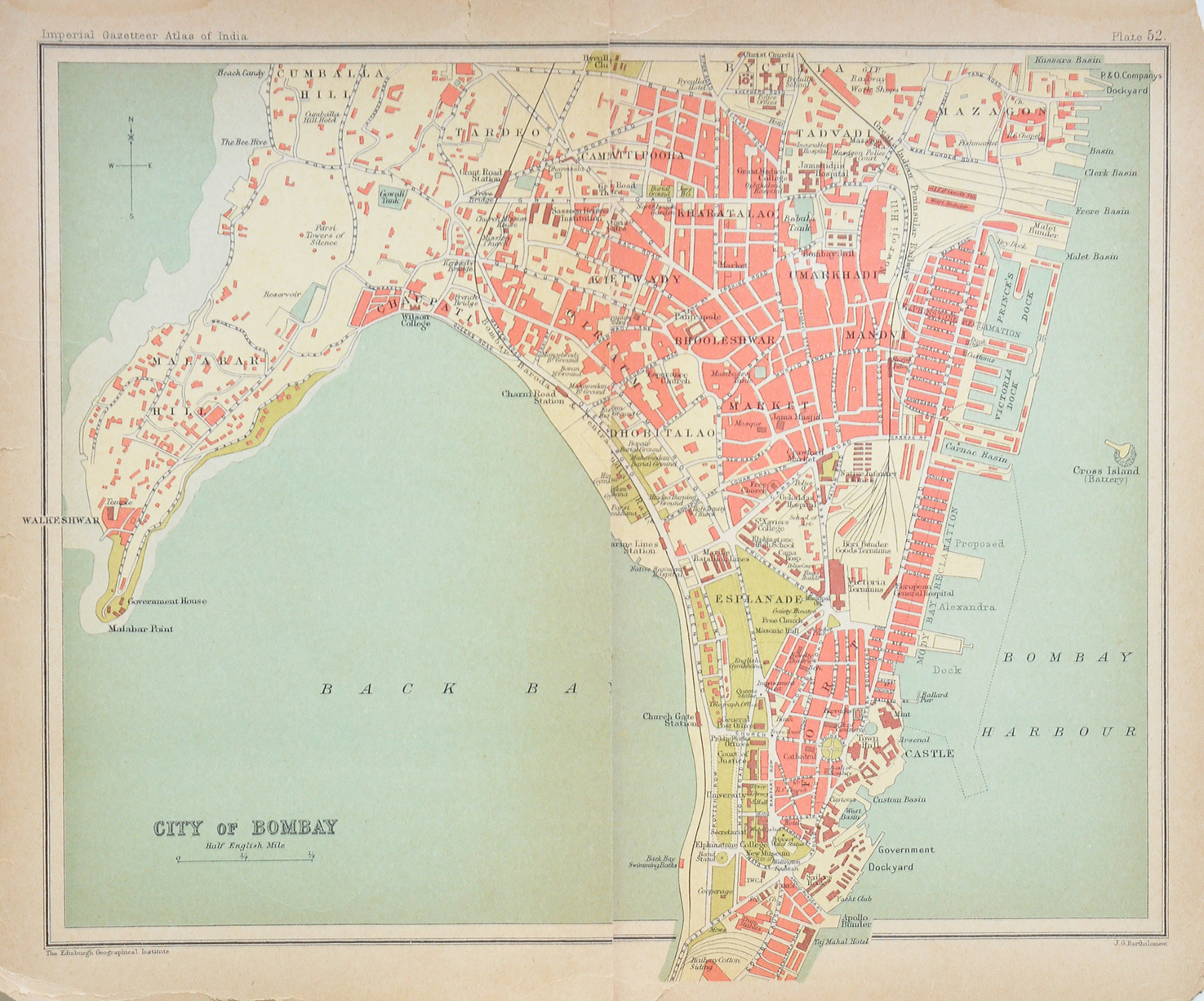
The City Of Bombay at the Turn of the 20th Century, 1903 Map
A 1903 map of the city of Bombay. Offers a fascinating glimpse into the city during the British era. The map captures the urban landscape at the turn of the 20th century, highlighting prominent districts such as Fort, Bhuleshwar, Mazagaon, Malabar Hill, and the bustling docks. Back Bay dominates the western side of the map, while the harbour and dockyards illustrate the maritime foundations that helped transform Bombay into one of the British Empire’s most important commercial centres. The careful detailing of roads, railway lines, public buildings, and neighborhoods provides valuable insight into the city’s colonial-era development.
The BB & CI Railway Line can be seen on the map emerging from beyond Grant Road Station, curving along Back Bay toward Churchgate Station before continuing in the direction of Colaba Station.
Areas that were once on the city’s edge, such as Malabar Hill and Walkeshwar, are shown in contrast to the densely built commercial quarters around the Fort and dock districts. Today, many of these locations remain integral parts of Mumbai, making the map a compelling record of continuity and change in one of India’s most iconic urban centers. Click image to enlarge.
Did you know – Malabar Hill appears relatively isolated, a reminder that it was once a quiet, elite residential area far removed from the crowded commercial core.