

Aerial View of Harbour & Docks British Bombay, 1931 Print

A 1931 print with an aerial view of the harbour and docks in British Era Bombay (Mumbai). The well-known Alexandra Docks is visible in the foreground. The equally well-known Victoria and Princess Docks are visible at the back. Towards the south of the Alexandra Docks is the Ballard Pier (not shown in the picture). The text is in French and translated it reads- “Built in a small island with a vast and perfectly sheltered port, Bombay is the second city and the first port of India. it absorbs all the traffic in the western region. it is the outlet for cotton land and also for all of central India. its location on the west coast of India makes it much closer to Europe than Madras or Calcutta…”
The 10 km long Mumbai Port Trust coast traces its origin to 19th-century British India. As trade grew the port grew both were interlinked at the time. Cotton was one of the main commodities for export. With Ballard Pier in the south, Sewri-Wadala mudflats in the north. To the west is a part of Bombay’s Fort area. Little more to the south would be the Ballard Pier building and Gateway of India both not visible in the image. Sewri’s mudflats attract scores of flamingos and other exotic birds and is a bird watchers paradise.
See post Aerial View Of Bombay – Rare Panoramic Postcard 1905. Read more- Fly away home.
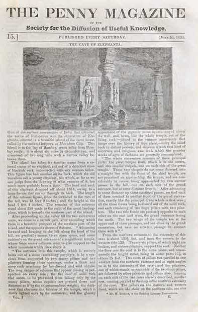
Did you know- the historical island of Elephanta is one of the six islands that lie in the harbour area.
From the collection- Raja Ravi Varma Commemorative Stamp Folder., Taj Mahal & Flying Carpet Plane – Old Photo 1932., Parsi Fire Temple Mumbai – Old Postcard 1905., Vintage Book 1912 – Kerala The Land Of Palms By I H Hacker