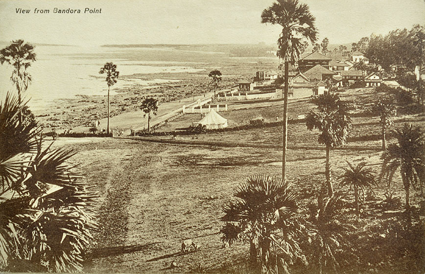
Bandora (now Bandra) During The British Era In Bombay, 1900 Postcard
A rare 1900 postcard with a view of Bandora, now Bandra, during the British era in Bombay. The photograph was most likely taken from the historic Bandra Fort, overlooking Mahim Bay and the sea. The beautiful landscape appears remarkably open, with only a handful of trees and a few homes overlooking the sea. In colonial records, “Bandora” was the name commonly used for present-day Bandra, then part of Salsette Island. The area was under Portuguese rule until 1739, when it was captured by the Marathas, before passing into British control in 1775. Over time, the name evolved into “Bandra,” a spelling that became widely adopted during the late nineteenth century.
The landmark most closely associated with the old name is the Bandra Fort, originally built by the Portuguese in 1640 as Forte de Bandora, also known as Castella de Aguada. Positioned at today’s Land’s End, the fort guarded the entrance to Mahim Bay and served as an important coastal lookout and freshwater stop for passing ships. This rare historical postcard preserves a glimpse of the landscape before modern Bombay expanded across its shoreline, offering a fascinating reminder of Bandra’s transformation from a strategic colonial outpost into one of the city’s most iconic waterfront neighbourhoods. Click image to enlarge.
Did you know – the word “Bandar,” derived from Persian, means “port” or “harbour,” reflecting Bandra’s long maritime history.