
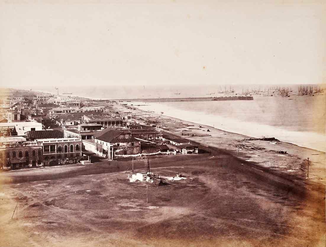
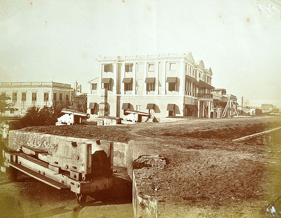
View Of George Town & Harbour In Colonial Era Madras, 1872 Photo
This rare 1872 photograph of George Town and the Madras Harbour is among the earliest views of colonial-era Madras. The photo was captured from the Madras High Court. The image shows the iron pier harbour jutting into the Bay of Bengal, with masted steamer ships anchored nearby. At this time, the concrete breakwater pontoons had not yet been built; they were added later to protect the harbour.
On the left side of the frame are the commercial buildings of Black Town, the native settlement of Madras, which was officially renamed George Town in 1910 in honour of King George V.
A closer look at the unmetalled road’s “T” junction corner reveals some buildings and sheds. This very corner would soon become the address of Parry & Co., giving rise to the famous name of the area, Parry’s Corner. The roads of this “T” junction evolved into two of Chennai’s busiest arteries:
-
NSC Bose Road (formerly Esplanade Road/China Bazaar Road)
-
Rajaji Road (formerly Beach Road / First Line Beach)
To the left stood the Madras Christian College building, while the area behind the pier would later transform into the General Post Office and the Beach Railway Station. Within a few decades, electric tram tracks would also be laid along NSC Bose Road, marking the beginning of modern transport in Madras. Click on photo to enlarge.
Did you know – Fort St George is located in the foreground and is not visible in this image.
From the collection – Raja Ravi Varma’s “Birth of Shakuntala” Oleograph 1894.,
