


Click on the photo for better view
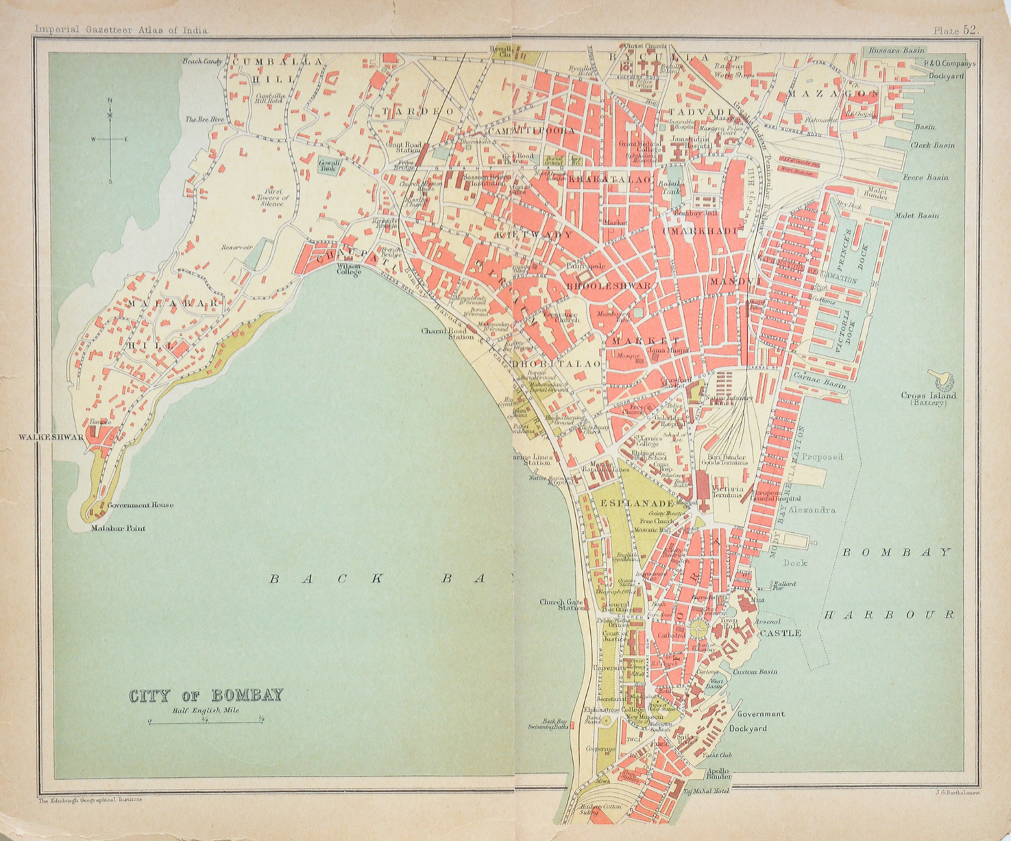
Bombay Fort, Colaba, Malabar Hill – Vintage Map 1924
This is a vintage 1924 map of Bombay Fort, Colaba, Malabar Hill, Girgaum, Byculla, and other regions. These were the principal centers of Bombay, now Mumbai under the period of British India era. Originally a group of seven islands that was unified by reclamation into a single landmass. Noticeable are the key locations- Malabar Hill, Girgaum(Girgaon), Kambala (Cumballa), Colaba, Fort area, Victoria dock, and so on.
Also visible is the location of the Government House at the tip of Malabar Hill. We now know the Government House as the Raj Bhavan. The map also shows the location of Bombay Castle. The castle served as the headquarters of the British in western India until the middle of the nineteenth century. The map measures 7 x 4½ inches, and was published by “John Murray, London.”
Read more- The reclamation of Mumbai – from the sea, and its people. See my post- The British Fort In Bombay Antique Plan 1755.
Did you know- the Kolis were one of the original inhabitants of the islands, they are of Dravidian race and numbered around 1000 in population when the British took control of the islands from the Portuguese.
From the collection- Vintage Photo Nawab Of Bhopal’s Hunting Bentley 1926 (#1)., Photo Maharaja of Bikaner with Lord Mountbatten., 1971 Raja Ravi Varma Commemorative First Day Cover., Book With Wellesley To Madras
