


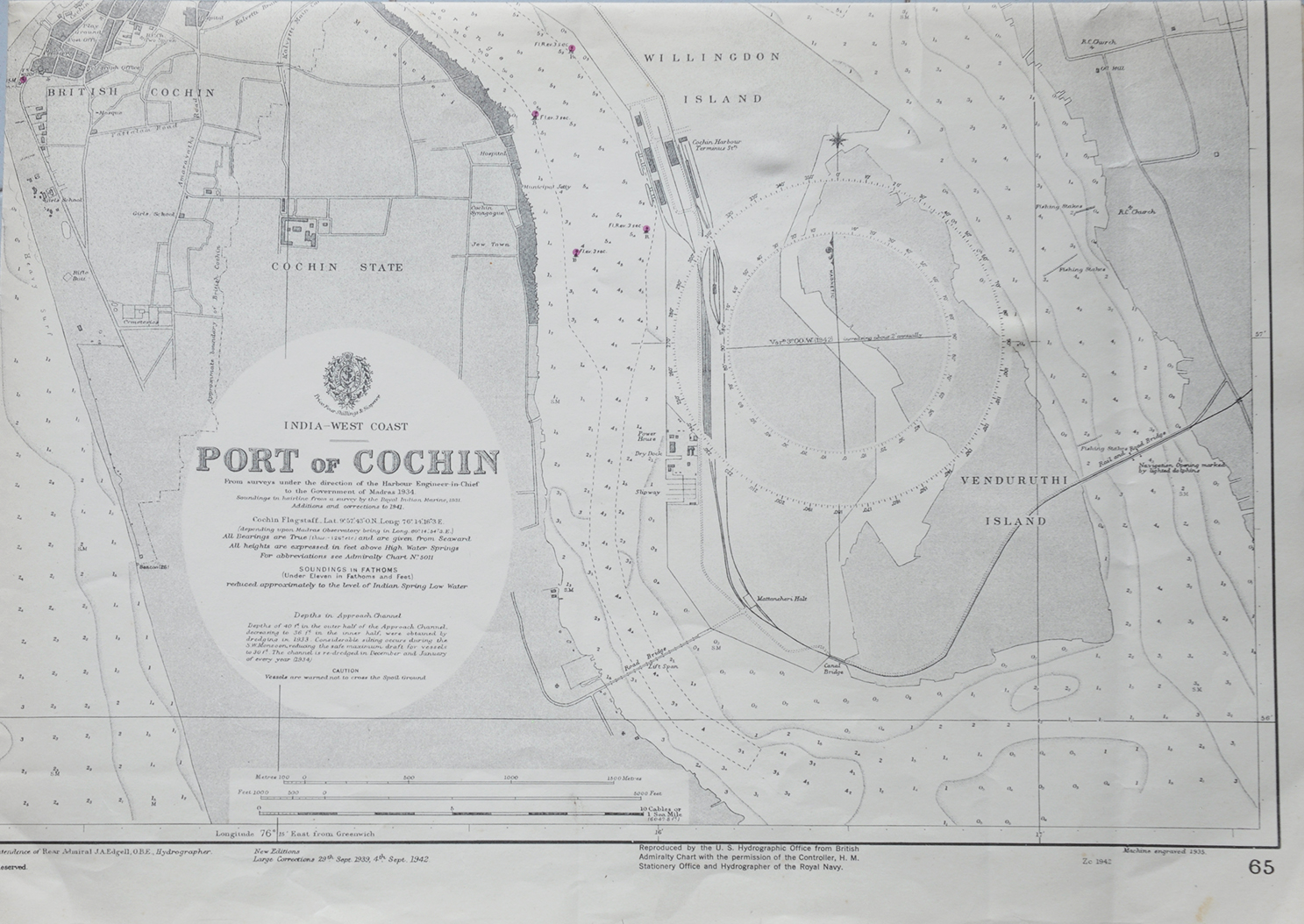
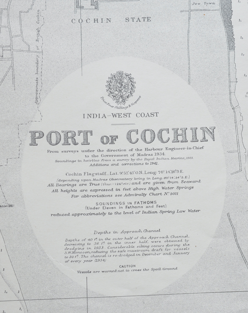


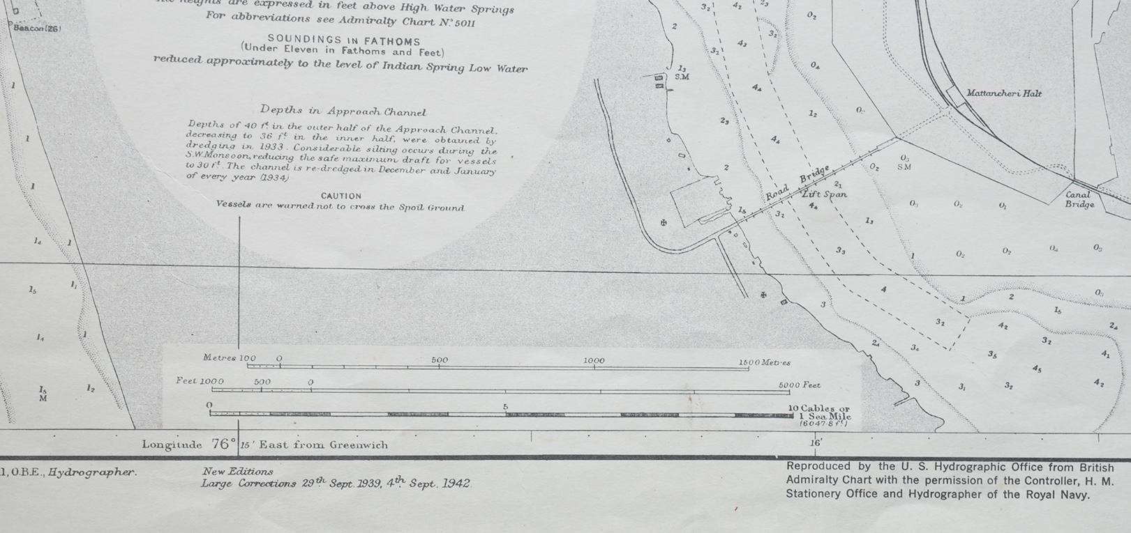

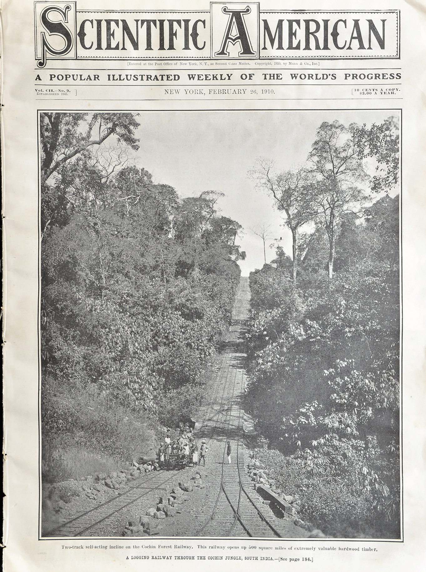
British Admiralty Chart, Port of Cochin Map, 1943
An old 1943 British Admiralty chart showing the nautical map of Port of Cochin, now Kochi. Admiralty Charts offer the widest official coverage of international shipping routes and ports, in varying detail. Maharaja Kerala Varma ruled Cochin State at the time. The map was reproduced by the US Hydrographic Office from British Admiralty Chart.
With permission from the Controller, H.M. Stationery Office, and Hydrographer of the Royal Navy. The map was done from surveys under the direction of Harbour Engineer-in-Chief to the Government of Madras 1943. There is a printed round seal of “Hydrographic Office, U.S. Navy” with an emblem of an eagle at the center of the seal.
The map shows the outline of Vypeen, Vallarpadam Island, Bolghatty, British Cochin (Fort Cochin), Willingdon Island, and the mainland of Cochin State. These nautical charts are in production for 200 years or more, produced by the UK Hydrographic Office. Primarily to show the coastal map of a particular place and provide an outline of the harbour channels. To avoid any accidents of ships and save and protect lives at sea. Click on the photo for better view.
Read also The history of nautical charts.
From the collection – 1964 M. Suriyamoorthy Charcoal Art Abstract (#11)., Gateway of India In Mumbai, 2 Old Photos 1942., Queen Victoria’s Statue In Bangalore, 2 Old 1910 PCs., Brahmin Family In India – Old Print 1861.
