
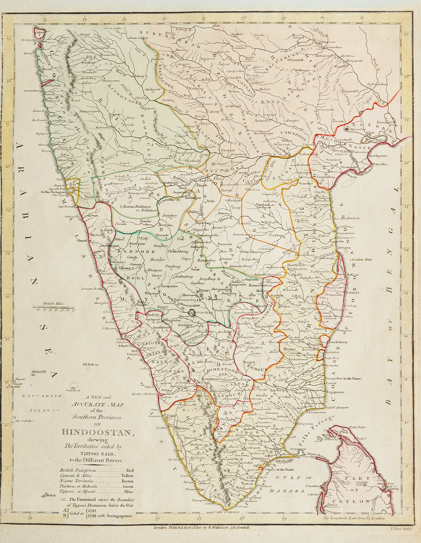
Tipu Sultan’s Ceded Territories After His Defeat, 1800 Map

A rare map of 1800 showing territories ceded by Tipu Sultan after his defeat in 1792 and 1799. Tipu Sultan, the ruler of Mysore was an expert soldier and had great military and administrative skills. His chief adversary was the British who had fought with his father Hyder Ali. They had conquered part of Hyder Ali’s territory and wealth in the two Anglo-Mysore Wars (1767-69 and 1780-84).
Tipu Sultan waged two further wars with the British, the third Anglo-Mysore War (1790-92) and the fourth Anglo-Mysore War (1798-99). Culminating in his defeat in Seringapattana where he died. This map shows Tipu Sultan’s ceded territories. The territories were divided among the four principal powers in India at the time: the British., Marathas., Carnatic, and the Nizam.
Also read The 1791 war against Tipu Sultan changed Bengaluru’s destiny.
Did you know – that Tipu Sultan is the innovator of the world’s first rocket. Two of these rockets, captured by the British at Seringapattana, are displayed in a museum in London.
Past posts – 1964 M. Suriyamoorthy Charcoal Art Abstract (#16)., Suez Canal And The British Empire, Old Photo 1880., Prongs Lighthouse Bombay – Old Postcard With FDC 1900., Brahmin Family In India – Old Print 1861.